

Where is the Calvert Formation?
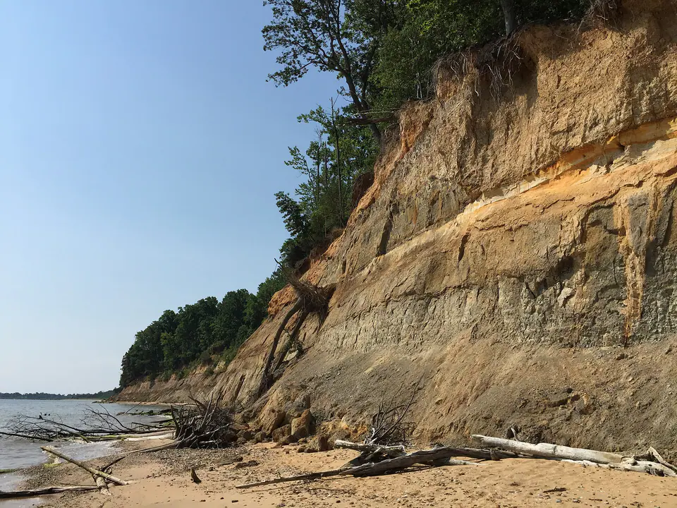
The formation is best known from Calvert Cliffs in Maryland and extends beneath parts of Delaware and Virginia. Stream valleys, coastal cliffs, wells, and construction cuts reveal sections, though many are inaccessible or unstable.
Members include diatomaceous, sandy, clayey, and marly intervals. Equivalent units replace the Calvert name farther north or south, and member boundaries are often recognized by fossils as well as rock type.
How did it form?
Marine transgressions deposited basal sand followed by clay, silt, marl, and diatom-rich sediment as water deepened. Repeated fining-upward cycles record shoreline movement and changing sediment supply.
Diatoms flourished in productive water, while shells accumulated during favorable bottom conditions. Later cliff erosion continually exposes and reworks fossils onto beaches.
Fossil record
Mollusks, diatoms, foraminifera, radiolarians, sharks, rays, bony fish, sea turtles, birds, whales, dolphins, and other marine vertebrates occur. Preservation and abundance differ strongly among beds.
A fossil found loose on a beach may have eroded from a cliff and traveled, so its exact bed is usually unknown. Scientific context is far better when a specimen’s layer is documented lawfully.
Compare observable anatomy in the fossil identification guides, then review the U.S. fossil collecting-law guide before disturbing any find. A formation-level record does not prove a fossil is present, exposed, common, or legal to collect at a particular place.
Minerals and geological resources
Quartz, clay minerals, calcite, and biogenic silica dominate, with glauconite, phosphate, pyrite, and iron oxides locally present.
Diatomaceous material and marl have local resource interest, but the formation’s greatest public value is its scientific fossil record. Cliff material should never be excavated where prohibited.
Identify rocks and minerals named in this guide
Use physical properties to investigate materials discussed above. A formation name or mapped location supports context, but it cannot identify a hand sample by itself.
What to know in the field
- Calvert Cliffs are actively eroding and can collapse without warning; remain away from cliff bases.
- Tides can trap visitors against bluffs, and collecting rules vary by park and shoreline owner.
- Loose beach fossils have reduced stratigraphic context even when identification is secure.
Formation, fossil, and mineral information is educational. It does not establish land ownership, legal access, collecting permission, specimen identity, or present-day field conditions.
Authoritative sources
This guide synthesizes the following sources in original language. Consult the linked records for local stratigraphic detail and the underlying scientific literature.
- Geolex Calvert unit record U.S. Geological Survey
- Geolex Calvert references U.S. Geological Survey
Editorial review: September 16, 2026.