

Where is the Ocala Limestone?
Ocala rock is exposed in parts of northern and central Florida and occurs beneath younger cover across much of the peninsula and neighboring states. State usage may divide or group the interval differently outside Florida.
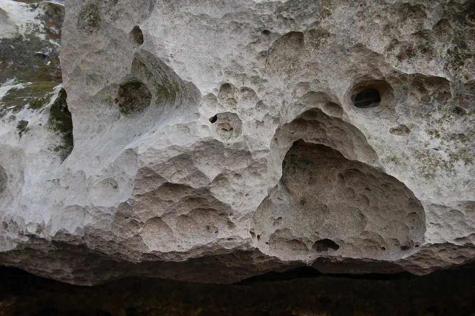
Quarries, springs, riverbanks, and sinkholes reveal sections, but surficial sand and clay hide most of its extent. Dissolution produces irregular contacts and cavities rather than consistently flat surfaces.
How did it form?
Foraminifera, mollusks, bryozoans, echinoids, and other organisms supplied carbonate sediment on a warm marine platform. Lime mud and shell debris accumulated far from major river-borne sand sources.
Freshwater later dissolved calcite, enlarging fractures and creating caves, conduits, springs, and sinkholes. Local recrystallization and dolomitization changed the original limestone fabric.
Fossil record
Large foraminifera, echinoids, mollusks, bryozoans, corals, and other marine fossils are common in many beds. Fossil assemblages have long been used to subdivide and correlate the unit.
Some rock is a mass of visible skeletal grains while fine or recrystallized intervals show fewer recognizable fossils. Preservation differs greatly among quarries and members.
Compare observable anatomy in the fossil identification guides, then review the U.S. fossil collecting-law guide before disturbing any find. A formation-level record does not prove a fossil is present, exposed, common, or legal to collect at a particular place.
Minerals and geological resources
Calcite dominates, with dolomite, clay, quartz sand, and phosphate locally present. Weathering may leave residual clay and insoluble sand above solutioned limestone.
The carbonate is part of the Floridan aquifer system and has been quarried for aggregate and lime. High permeability also makes groundwater vulnerable where protective cover is thin.
Identify rocks and minerals named in this guide
Use physical properties to investigate materials discussed above. A formation name or mapped location supports context, but it cannot identify a hand sample by itself.
What to know in the field
- Sinkholes, submerged cavities, and steep quarry faces are serious hazards.
- Spring and cave access may be restricted for safety, habitat, or water-resource protection.
- Do not infer a stable ground surface from generalized limestone mapping.
Formation, fossil, and mineral information is educational. It does not establish land ownership, legal access, collecting permission, specimen identity, or present-day field conditions.
Authoritative sources
This guide synthesizes the following sources in original language. Consult the linked records for local stratigraphic detail and the underlying scientific literature.
- Geolex Ocala unit record U.S. Geological Survey
- Geolex Ocala references U.S. Geological Survey
Editorial review: September 16, 2026.