

Major geologic regions of Florida
Northern and central karst
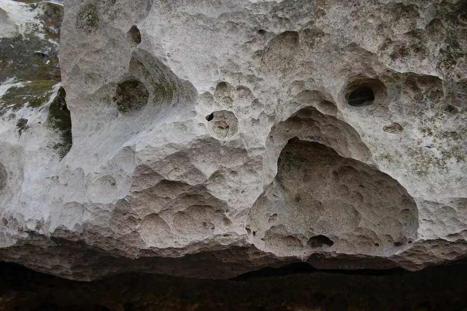
Where limestone lies near the surface or beneath permeable sand, dissolution produces springs, caves, sinkholes, disappearing streams, and internally drained basins.
Central ridges and phosphate districts
Sandy uplands and reworked marine deposits include important phosphate-bearing strata. Relief is modest but meaningful in a state dominated by low elevations.
Atlantic and Gulf coastal lowlands
Barrier islands, beach ridges, dunes, lagoons, marshes, estuaries, and shallow marine deposits respond to waves, currents, storms, sediment supply, subsidence, and sea-level change.
South Florida carbonate and wetlands
Young limestone, marl, peat, and coastal deposits underlie a very low-gradient landscape. Surface water and groundwater are tightly connected.
Geologic history
Florida’s deep basement is largely hidden, so its familiar geology begins with a long record of carbonate-platform and marginal-marine sedimentation. Warm shallow seas allowed shells and other biological material to accumulate into limestone, while dolomitization, cementation, and dissolution later modified those rocks.
Cenozoic sea-level changes repeatedly shifted shorelines across the platform. Sand, clay, phosphate-rich sediment, shell beds, reefs, and limestone formed or were reworked in different environments. Ocala and Suwannee limestones represent only part of a thicker, regionally variable succession.
During the Quaternary, repeated high and low sea levels built terraces, beach ridges, dunes, coastal barriers, and shallow-water deposits. Rivers, wetlands, peat formation, groundwater dissolution, storms, and modern coastal transport continue reshaping the state.
Common and significant rocks and minerals
Limestone, dolostone, and coquina
Carbonate rocks range from fine-grained and fossiliferous limestone to shell-fragment coquina. Dissolution creates porosity, caves, springs, and sinkholes.
Quartz sand and clay
Loose sand blankets much of the surface; clay-rich layers affect drainage and can locally confine groundwater.
Phosphate minerals
Phosphatic sediment is concentrated in particular formations and mining districts. “Phosphate rock” is a rock resource rather than one easily identified hand-specimen mineral.
Calcite, aragonite, dolomite, and gypsum
Carbonate and sulfate minerals occur in rocks, shells, cavities, and subsurface settings.
Agatized coral, chert, and heavy minerals
Silica can replace coral or form chert; resistant heavy minerals such as zircon and staurolite occur in some sands. Context and access rules still apply.
A statewide occurrence does not mean a material is present, collectible, or economically valuable at a particular location. Confirm the mapped unit, land status, and applicable rules.
Fossil record
Florida’s fossil record includes abundant marine shells, corals, echinoids, shark teeth, and other organisms, plus terrestrial and freshwater vertebrates from periods when land was exposed. Bones and teeth may be reworked from older deposits into younger river sediment.
Petrification can replace bone, wood, or coral with minerals. Archaeological artifacts are not fossils and are governed by different laws. Location, layer, and association are essential to scientific interpretation.
Use the fossil identification guides to compare anatomy and preservation, and check the collecting-law guide before touching or moving a find. Statewide fossil history does not establish site-level presence, ownership, access, or permission.
Groundwater and geologic hazards
The Floridan aquifer system is hosted largely in carbonate rock, while shallower aquifers occur in sand and other units. Springs and sinkholes demonstrate close groundwater–surface-water connections, but local confining beds and water chemistry vary.
Sinkholes, coastal erosion, storm surge, flooding, saltwater intrusion, unstable quarry faces, and changes in groundwater level are important geologic concerns. A depression is not automatically a sinkhole, and a statewide susceptibility map is not a site investigation.
Field notes and limitations
- Loose sand or shell can conceal the bedrock and its contacts.
- Never enter a sinkhole, cave, quarry, mine, or spring vent without authorization and proper training.
- Florida fossil collecting rules vary by land, material, and activity; archaeological material must not be disturbed.
- Treat coastal cliffs, riverbanks, lightning, heat, wildlife, and rapidly changing water conditions as field hazards.
This guide is educational. It is not a legal boundary, access determination, mineral-rights opinion, professional hazard assessment, water-well evaluation, or collecting authorization.
Authoritative state geology sources
LithoMap wrote this guide in original language from the broad patterns supported by these state geological-survey and agency resources.
- Florida Geological Survey Florida Department of Environmental Protection
- Florida Rocks & Minerals Florida Geological Survey
- Fossils and Artifacts Florida Geological Survey
- Florida Geological Survey Maps and Data Florida Geological Survey
Editorial review: September 17, 2026.