State geology library

United States geology, one state at a time

State guides connect broad geologic history to recognizable regions, rocks, minerals, fossils, groundwater, hazards, and the named formations already covered in LithoMap’s field library.

Download LithoMapPut U.S. geology in your pocket.Choose Google Play or the App Store.

Core states, then balanced expansion

The core collection begins with the six mandatory western states—Oregon, Utah, Colorado, Arizona, Wyoming, and Montana—then adds supplemental states from other regions. Future additions will continue in balanced, demand-led batches rather than creating thin coverage for every state at once.

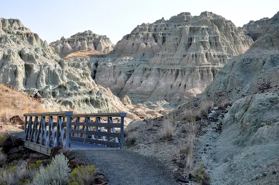
Blue-green John Day Formation badlands along the Lower Blue Basin Trail in Oregon
Pacific Coast

Oregon geology

Oregon records the assembly of oceanic terranes, long-lived subduction, enormous flood-basalt eruptions, younger Cascade volcanism, inland lakes, Ice Age floods, and active coastal hazards in one unusually varied state.

  • Broad setting: Active continental margin above the Cascadia subduction zone
  • Major rock record: Accreted terranes, marine sediment, volcanic arcs, flood basalt, and young surficial deposits
  • Notable fossils: Cenozoic plants and mammals, marine invertebrates, and petrified wood
Explore Oregon geology
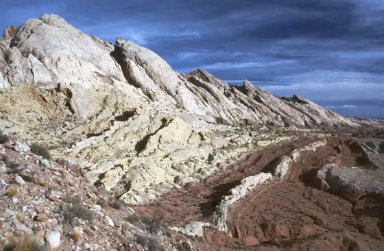
Pale Navajo Sandstone forming a prominent ridge in the San Rafael Reef, Utah
Colorado Plateau / Rockies

Utah geology

Utah exposes a remarkably continuous record of ancient seas, deserts, rivers, lakes, mountain building, volcanism, crustal extension, Ice Age Lake Bonneville, and modern erosion across three major physiographic provinces.

  • Major provinces: Colorado Plateau, Basin and Range, and Middle Rocky Mountains
  • Oldest exposed rocks: Precambrian rocks older than 2.5 billion years in limited mountain exposures
  • Signature strata: Paleozoic carbonates and Mesozoic red-bed sandstone and mudstone
Explore Utah geology
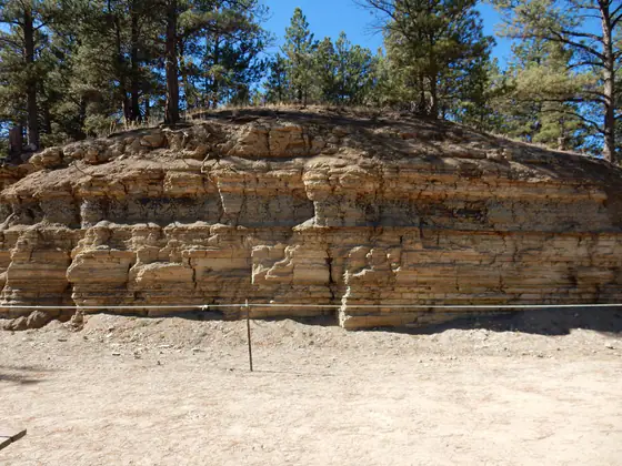
Paper shale exposure of the Florissant Formation at a fossil quarry in Colorado
Colorado Plateau / Rockies

Colorado geology

Colorado spans more than 2.7 billion years of geologic history from ancient crystalline basement through inland seas, dinosaur-bearing basins, Rocky Mountain uplift, volcanism, glaciation, and the continuing erosion of plains, peaks, and plateaus.

  • Major provinces: Great Plains, Southern Rocky Mountains, and Colorado Plateau
  • Oldest record: Precambrian metamorphic and igneous rocks older than 2.5 billion years
  • Signature fossils: Morrison dinosaurs, Florissant insects and plants, Green River lake life, and Ice Age mammals
Explore Colorado geology
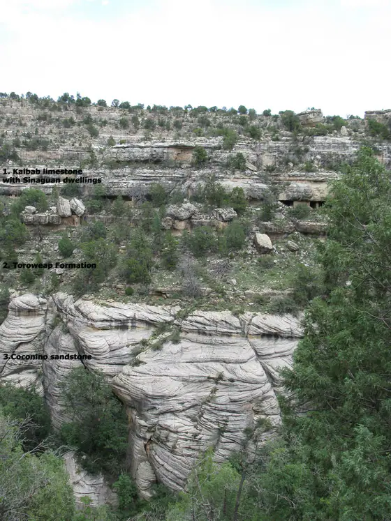
Layered Kaibab Limestone and associated strata at Walnut Canyon National Monument, Arizona
Colorado Plateau / Rockies

Arizona geology

Arizona joins the layered canyon country of the Colorado Plateau to the crystalline highlands of the Transition Zone and the fault-bounded mountains and basins of the desert Southwest, exposing an unusually long and readable geologic record.

  • Major provinces: Colorado Plateau, Central Highlands Transition Zone, and Basin and Range
  • Deep-time record: Precambrian basement and sedimentary successions through Cenozoic basin fill and volcanism
  • Signature materials: Sandstone, limestone, volcanic rock, copper minerals, petrified wood, and young basin sediment
Explore Arizona geology
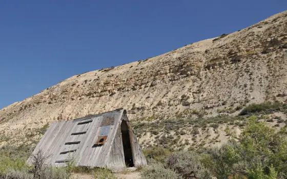
Layered Green River Formation rising behind the historic Haddenham Cabin at Fossil Butte National Monument
Colorado Plateau / Rockies

Wyoming geology

Wyoming exposes ancient continental crust in mountain cores, thick Paleozoic and Mesozoic marine and continental strata, Laramide uplifts and basins, Eocene lake deposits, world-famous fossils, active faults, and Yellowstone volcanism.

  • Landscape framework: Basement-cored mountain uplifts separated by broad sedimentary basins and high plains
  • Ancient rocks: Archean crust in ranges including the Wind River and Bighorn Mountains
  • Signature records: Morrison dinosaurs, Green River lake fossils, coal basins, and Yellowstone volcanic deposits
Explore Wyoming geology
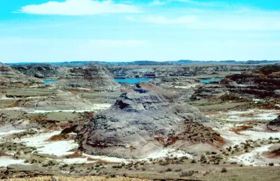
Eroded Hell Creek Formation badlands near Fort Peck Reservoir, Montana
Colorado Plateau / Rockies

Montana geology

Montana joins Archean crust and mineralized mountain belts in the west to folded Rocky Mountain fronts, intermontane valleys, glaciated plains, fossil-rich badlands, and thick sedimentary basins across the east.

  • Broad provinces: Northern Rocky Mountains, intermontane basins, Great Plains, and glaciated northern lowlands
  • Oldest rocks: Archean crystalline basement exposed in southwestern uplifts
  • Signature fossils: Hell Creek dinosaurs, Cretaceous marine fossils, Paleozoic invertebrates, and Cenozoic mammals
Explore Montana geology
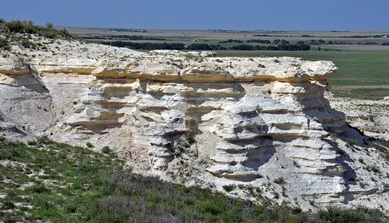
Rhythmically layered chalk badlands of the Niobrara Formation near Castle Rock, Kansas
Great Plains

Kansas geology

Kansas geology is a westward-younging archive of shallow seas, coastal plains, rivers, grasslands, volcanic ash, glaciers, and modern stream deposits expressed across eleven physiographic regions.

  • Physiographic regions: Eleven, from the Ozark Plateau to the High Plains
  • Oldest surface rocks: Mississippian limestone in the far southeast
  • Signature record: Pennsylvanian–Permian cyclic strata and Cretaceous Western Interior Seaway deposits
Explore Kansas geology
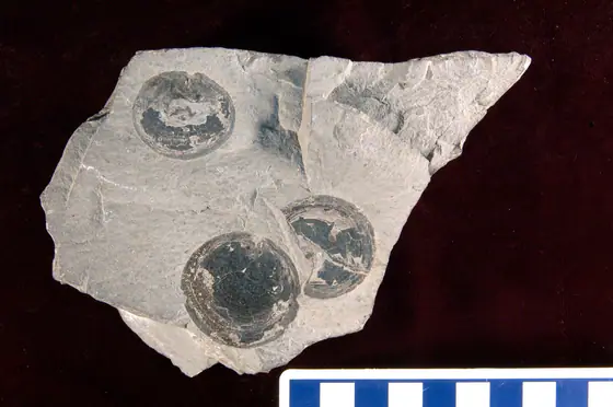
Ordovician brachiopod fossils preserved in limestone of the Trenton Group
Midwest / Great Lakes

Michigan geology

Michigan combines ancient Precambrian rocks and mineral districts in the Upper Peninsula with a bowl-shaped Paleozoic sedimentary basin, then overlays much of that bedrock with glacial deposits and Great Lakes shore processes.

  • Central structure: Michigan Basin, with generally younger Paleozoic bedrock toward its center
  • Ancient foundation: Precambrian volcanic, sedimentary, metamorphic, and intrusive rocks in the Upper Peninsula
  • State fossil: Petoskey stone, a polished or weathered fragment of Devonian colonial coral
Explore Michigan geology
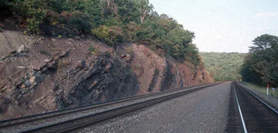
Red Catskill Formation rocks exposed along Horseshoe Curve in Pennsylvania
Appalachians

Pennsylvania geology

Pennsylvania spans folded mountains, plateaus, valleys, metamorphic uplands, a small coastal plain, coal fields, carbonate valleys, and glacial terrain shaped by repeated seas, continental collision, erosion, and ice.

  • Physiographic provinces: Six, with the Appalachian Plateaus, Ridge and Valley, and Piedmont covering most of the state
  • Dominant record: Paleozoic sedimentary rocks deformed during Appalachian mountain building
  • Major resources: Coal, limestone, aggregate, clay, sandstone, oil, gas, and groundwater
Explore Pennsylvania geology
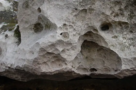
Pale fossiliferous Ocala Limestone exposed in Florida
Gulf / Atlantic

Florida geology

Florida is a low-relief carbonate platform mantled by sand, clay, shell, peat, and river or coastal deposits, with geology closely tied to aquifers, springs, caves, sinkholes, fossils, phosphate, and changing sea level.

  • Platform setting: Thick carbonate and sedimentary cover above much older continental basement
  • Common surface materials: Quartz sand, clay, limestone, dolostone, coquina, peat, and shell-rich sediment
  • Signature processes: Carbonate dissolution, spring flow, sinkhole development, coastal transport, and sea-level change
Explore Florida geology