

Major geologic regions of Oregon
Coast Range and coast
Eocene oceanic volcanic basement and younger marine sedimentary rocks form much of the Coast Range. Headlands, wave-cut cliffs, dunes, estuaries, and uplifted marine terraces reveal continuing interaction between bedrock, sediment, and the Pacific.
Klamath and Blue Mountains
Complex belts of accreted oceanic and island-arc rocks preserve pieces added to western North America before the modern Cascade arc developed. Metamorphic rocks, intrusive bodies, serpentinite, and mineralized districts make these areas geologically intricate.
Cascades and volcanic plateaus
The Western and High Cascades contain volcanic and volcaniclastic rocks produced above the subducting Juan de Fuca plate. Farther east and north, Columbia River Basalt Group flows and younger High Lava Plains volcanism cover older foundations.
Basin and Range and High Desert
Fault-bounded basins, volcanic fields, dry lake beds, and younger sediment characterize southeastern Oregon. Extension has stretched the crust, while local volcanism and closed-basin drainage shaped the modern landscape.
Geologic history
Oregon did not begin as a single block of continental crust. Paleozoic and Mesozoic oceanic fragments, volcanic arcs, and sedimentary packages were attached to the continental margin through subduction and collision. Intrusions welded portions of that foundation together, and later erosion exposed parts of it in the Klamath and Blue Mountains.
During the Cenozoic, volcanic arcs and coastal basins repeatedly changed position and character. Eocene volcanic rocks of the Siletz terrane underlie much of the Coast Range, while thick marine sediment accumulated around and above that basement. Inland volcanic centers produced the Clarno and John Day successions, whose ash-rich strata preserve an exceptional record of changing ecosystems.
Miocene flood basalts spread across northern and eastern Oregon, followed by continued Cascade and High Lava Plains volcanism. Pleistocene glaciers, Lake Missoula floods, pluvial lakes, dunes, and river deposits then remodeled the surface. Today, subduction, active volcanoes, crustal faults, landslides, and coastal processes continue the story rather than merely preserving it.
Common and significant rocks and minerals
Basalt
Oceanic terranes, Coast Range volcanics, Cascade lavas, and Columbia River flood basalts make basalt one of Oregon’s most widespread rock types.
Tuff and volcanic ash
Explosive eruptions produced ash beds and welded tuffs; altered ash contributes clay-rich strata and helps date fossil-bearing sequences.
Marine sandstone and mudstone
Coastal basins preserve thick sedimentary successions that can contain marine fossils and influence landslide behavior.
Agate, jasper, and petrified wood
Silica moving through volcanic and sedimentary environments filled cavities or replaced organic material. Occurrence does not establish collecting rights.
Gold and other metallic minerals
Historic districts in southwestern and northeastern Oregon reflect mineralizing fluids associated with older terranes and intrusions; mines and claims require special caution.
A statewide occurrence does not mean a material is present, collectible, or economically valuable at a particular location. Confirm the mapped unit, land status, and applicable rules.
Fossil record
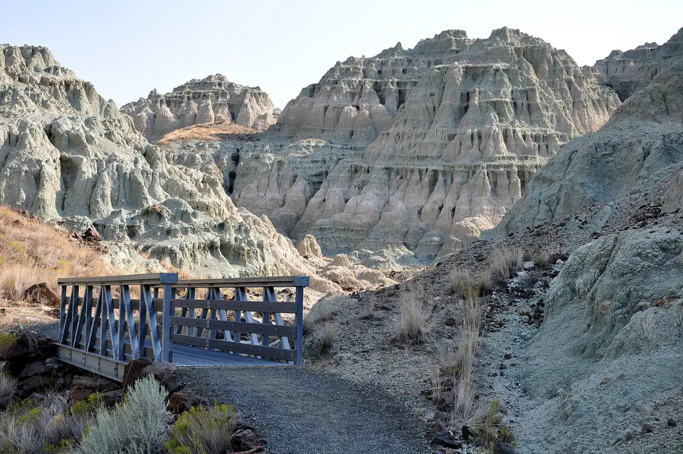
The John Day basin preserves plants, mammals, insects, and other organisms across a long span of the Cenozoic. Fossils occur in particular beds and depositional settings, not uniformly through every colorful outcrop. Volcanic ash layers provide time markers but can also weather into deceptively similar slopes.
Marine fossils occur in Coast Range sedimentary rocks, while petrified wood and plant impressions occur in several volcanic and lake-related settings. Fossil presence, scientific importance, and collection rules depend on locality, land ownership, and fossil type; vertebrate fossils on federal land generally require a research permit.
Use the fossil identification guides to compare anatomy and preservation, and check the collecting-law guide before touching or moving a find. Statewide fossil history does not establish site-level presence, ownership, access, or permission.
Groundwater and geologic hazards
Fractured volcanic rock, basin-fill sediment, and coastal sedimentary units store and transmit groundwater differently. A statewide map describes regional materials, but local wells depend on fracture networks, unit thickness, recharge, and water chemistry.
Oregon’s hazards include Cascadia megathrust earthquakes and tsunamis, volcanic eruptions, crustal earthquakes, landslides, debris flows, coastal erosion, and flooding. A geologic unit may explain susceptibility, but current hazard maps and emergency guidance—not a general geology page—should guide decisions.
Field notes and limitations
- Distinguish bedrock from transported river, beach, glacial, or landslide material.
- Wet volcanic ash and marine sediment slopes can be unstable or extremely slick.
- Never enter abandoned mines, sea caves, closed volcanic areas, or active quarry faces.
- Verify land ownership, claims, park rules, and fossil regulations before collecting.
This guide is educational. It is not a legal boundary, access determination, mineral-rights opinion, professional hazard assessment, water-well evaluation, or collecting authorization.
Authoritative state geology sources
LithoMap wrote this guide in original language from the broad patterns supported by these state geological-survey and agency resources.
- Oregon: A Geologic History Oregon Department of Geology and Mineral Industries
- Geologic Provinces of Oregon Oregon Department of Geology and Mineral Industries
- Geologic Map of Oregon Oregon Department of Geology and Mineral Industries
Editorial review: September 17, 2026.