

Major geologic regions of Pennsylvania
Appalachian Plateaus
Broadly layered sedimentary rocks are dissected into hills and valleys. Bituminous and anthracite coal fields, river gorges, and resistant sandstone ridges reflect both stratigraphy and erosion.
Ridge and Valley
Folded and faulted Paleozoic strata create long parallel ridges and valleys. Resistant sandstone commonly supports ridges; carbonate or shale units more often underlie valleys.
Piedmont and New England provinces
Metamorphic and igneous rocks, fault-bounded basins, and deformed sedimentary units record older continental collisions and later Mesozoic rifting.
Central Lowlands and Coastal Plain
A small Lake Erie lowland includes glacial and lake deposits, while the southeastern Atlantic Coastal Plain is a narrow belt of younger unconsolidated sediment.
Geologic history
Precambrian and early Paleozoic crustal fragments and continental-margin deposits were followed by long intervals of shallow seas. Sandstone, shale, limestone, and dolostone accumulated as shorelines moved and sediment sources changed. Marine fossils document many of these environments.
Several Appalachian mountain-building events compressed, folded, faulted, metamorphosed, and uplifted the eastern margin. Devonian Catskill delta systems spread red sediment westward, and later Pennsylvanian wetlands produced peat that became coal. Rock resistance and structure guided later erosion into the state’s distinctive provinces.
Mesozoic extension opened fault basins and accompanied diabase intrusion in the southeast. Much later, Pleistocene glaciers reached northern and northwestern Pennsylvania, leaving till, outwash, lake deposits, and altered drainage, while periglacial processes affected areas beyond the ice margin.
Common and significant rocks and minerals
Sandstone, shale, limestone, and dolostone
These layered sedimentary rocks dominate much of the state and strongly influence ridges, valleys, groundwater, soils, and construction.
Anthracite and bituminous coal
Different coal fields reflect burial, deformation, heat, and stratigraphic history. Mine lands can contain unstable ground, gas, polluted drainage, and private rights.
Slate and metamorphic rock
Eastern metamorphic belts include slate, schist, gneiss, and related rocks shaped during mountain building.
Diabase
Dark Mesozoic intrusions cut sedimentary rocks in southeastern basins and commonly form resistant ridges or boulder fields.
Calcite, quartz, pyrite, and clay minerals
Common minerals occur in many settings, while more unusual species are localized. More than 275 minerals have been verified statewide according to the Geological Survey.
A statewide occurrence does not mean a material is present, collectible, or economically valuable at a particular location. Confirm the mapped unit, land status, and applicable rules.
Fossil record
Pennsylvania contains abundant Paleozoic fossils, including trilobites, brachiopods, corals, bryozoans, crinoids, mollusks, fish remains, and trace fossils. Devonian rocks are especially prominent, but fossil assemblages differ sharply between marine, deltaic, and continental units.
Coal-bearing rocks preserve plants and associated terrestrial or freshwater evidence. The state survey reports thousands of fossil plant and animal species, yet fossils are not uniformly distributed and a loose specimen may have been transported.
Use the fossil identification guides to compare anatomy and preservation, and check the collecting-law guide before touching or moving a find. Statewide fossil history does not establish site-level presence, ownership, access, or permission.
Groundwater and geologic hazards
Groundwater behavior follows fractures, bedding, carbonate dissolution, mine workings, and the permeability of surficial deposits. Karst valleys can contain sinkholes and rapid groundwater pathways, while mine drainage can change water chemistry.
Flooding, landslides, rockfall, sinkholes, abandoned mines, mine subsidence, radon, and naturally occurring or industrially influenced water-quality issues vary across the provinces. Current site-specific maps and professional evaluation are necessary for decisions.
Field notes and limitations
- Long ridge-and-valley patterns reflect both folded structure and erosion.
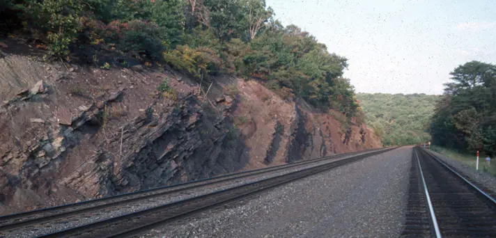
- Roadcuts and railroad exposures are hazardous and are not implied collecting access.
- Coal mines, quarries, and abandoned workings require permission and professional safety controls.
- Use the state survey’s maps to separate similar-looking Devonian and Mississippian units.
This guide is educational. It is not a legal boundary, access determination, mineral-rights opinion, professional hazard assessment, water-well evaluation, or collecting authorization.
Authoritative state geology sources
LithoMap wrote this guide in original language from the broad patterns supported by these state geological-survey and agency resources.
- Geology of Pennsylvania Pennsylvania Geological Survey
- Landforms and physiographic provinces Pennsylvania Geological Survey
- Identifying and Collecting Pennsylvania Geological Survey
- The Geological Story of Pennsylvania Pennsylvania Geological Survey
Editorial review: September 17, 2026.