

Major geologic regions of Colorado
Great Plains and Denver Basin
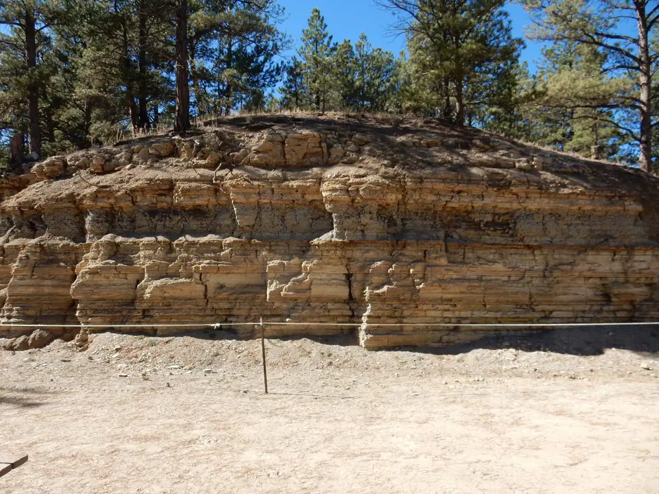
Nearly horizontal to gently tilted sedimentary strata underlie the eastern plains. Near the mountain front, uplift exposed and steepened older layers into hogbacks, ridges, and landmarks such as the Flatirons and Garden of the Gods.
Southern Rocky Mountains
Precambrian basement, Paleozoic and Mesozoic remnants, Laramide uplifts, younger volcanic fields, and high intermountain basins create a complex central belt. Glaciers sharpened many high valleys and peaks.
Colorado Plateau and western basins
Layered sedimentary rocks, deeply incised rivers, mesas, canyon country, and structural basins characterize western Colorado. Salt-bearing strata locally deform, dissolve, or influence groundwater.
San Juan volcanic region
Large Oligocene volcanic centers produced thick lava, ash-flow tuff, calderas, and hydrothermal mineral systems in southwestern Colorado.
Geologic history
Colorado’s Precambrian rocks record continental growth, deformation, metamorphism, and intrusion. Younger seas and continental environments laid sandstone, shale, limestone, evaporites, and red beds over that foundation. The Ancestral Rocky Mountains rose and eroded during Pennsylvanian and Permian time, feeding adjacent basins.
Mesozoic deserts, rivers, floodplains, shorelines, and the Western Interior Seaway produced fossil-rich strata. The Morrison Formation preserves continental ecosystems, while Cretaceous sandstone and shale record repeated marine advances and retreats. Late Cretaceous through early Cenozoic compression raised basement-cored Laramide ranges and deepened neighboring basins.
Cenozoic erosion filled basins as volcanism reshaped central and southwestern Colorado. Florissant lake deposits and ash preserved delicate organisms; western basins accumulated Green River strata. Later regional uplift, river incision, alpine glaciation, and ongoing slope processes produced much of the modern relief.
Common and significant rocks and minerals
Granite, gneiss, and schist
Precambrian crystalline rocks form mountain cores and preserve multiple episodes of metamorphism and intrusion.
Sandstone, shale, and limestone
Paleozoic and Mesozoic strata form plains, plateaus, hogbacks, cliffs, aquifers, fossil beds, and energy-bearing basins.
Volcanic rock and tuff
Lava, ash-flow tuff, breccia, and intrusive rock dominate parts of the San Juan Mountains and other volcanic fields.
Gold, silver, lead, zinc, copper, and molybdenum minerals
Hydrothermal systems and intrusions created major districts along the Colorado Mineral Belt. Historic workings can be claimed, unstable, contaminated, or gas-filled.
Gypsum, halite, nahcolite, coal, and construction materials
Industrial minerals and rock resources occur in specific basins and formations; statewide presence never implies a local collectible occurrence.
A statewide occurrence does not mean a material is present, collectible, or economically valuable at a particular location. Confirm the mapped unit, land status, and applicable rules.
Fossil record
Colorado fossils span marine invertebrates, fish, dinosaurs, tracks, leaves, insects, mammals, and Ice Age animals. The Morrison, Green River, White River, and Florissant units are especially well known, but each represents a different time, environment, and preservation pathway.
The state fossil is Stegosaurus. Vertebrate fossils and scientifically important localities are protected on many public lands, and national parks and monuments prohibit collecting. Record exact stratigraphic context rather than treating every exposed fossil-bearing unit as interchangeable.
Use the fossil identification guides to compare anatomy and preservation, and check the collecting-law guide before touching or moving a find. Statewide fossil history does not establish site-level presence, ownership, access, or permission.
Groundwater and geologic hazards
Groundwater occurs in basin sediment, sandstone, carbonate rock, volcanic deposits, and fractured crystalline rock. Faults, evaporite dissolution, mine workings, unit thickness, and recharge can change yield and chemistry over short distances.
Rockfall, landslides, debris flows, avalanches, swelling clay, collapsible soil, abandoned mines, radon, floods, and earthquakes affect different parts of Colorado. General geologic setting explains susceptibility, but current local hazard mapping is necessary for decisions.
Field notes and limitations
- High elevation adds lightning, exposure, snow, and altitude hazards to ordinary field risks.
- Do not enter mines or collect on active claims, private property, or protected sites.
- Red sandstone, dark shale, and volcanic tuff recur in multiple units; confirm map position and contacts.
- Treat fossils, artifacts, and historic mining remains as separate protected resources.
This guide is educational. It is not a legal boundary, access determination, mineral-rights opinion, professional hazard assessment, water-well evaluation, or collecting authorization.
Authoritative state geology sources
LithoMap wrote this guide in original language from the broad patterns supported by these state geological-survey and agency resources.
- Geology of Colorado Colorado Geological Survey
- Prairie, Peak and Plateau Colorado Geological Survey
- Fossils of Colorado Colorado Geological Survey
- Colorado Groundwater Atlas Colorado Geological Survey
Editorial review: September 17, 2026.