
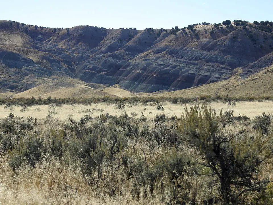

Where is the Morrison Formation?
The Morrison is exposed across a wide belt of the western United States. Its best-known outcrops lie on the Colorado Plateau and along the flanks of Rocky Mountain uplifts, but equivalent named Morrison rocks extend much farther across the interior.
Its appearance changes from place to place. Resistant sandstone ledges commonly mark former river channels, while softer, colorful mudstones represent floodplain soils, ponds, and low-energy basins. Member names also vary regionally, so a local geologic map is essential for precise identification.
How did it form?
Morrison sediment accumulated in a continental landscape crossed by rivers. Sand and gravel settled in channels; silt and clay spread across floodplains; and carbonate mud formed in some lakes and wetlands. Volcanic ash altered into swelling clay in portions of the unit, especially the Brushy Basin Member.
The formation is not one uniform bed. Its members intertongue, pinch out, and change composition across hundreds of miles. Those changes let geologists reconstruct drainage patterns, volcanic influence, soil formation, and climate during the closing part of the Jurassic.
Fossil record
The Morrison preserves one of North America’s most celebrated dinosaur records. Documented animals include large sauropods, stegosaurs, meat-eating theropods, and smaller plant-eating dinosaurs, alongside turtles, crocodile relatives, fish, amphibians, mammals, freshwater mollusks, and insects.
Bones are not evenly distributed. Channel sandstones and rapidly buried deposits may concentrate and protect remains, while broad mudstone intervals can be comparatively sparse. A formation-level identification therefore predicts geological context, not the presence of a fossil at a particular spot.
Compare observable anatomy in the fossil identification guides, then review the U.S. fossil collecting-law guide before disturbing any find. A formation-level record does not prove a fossil is present, exposed, common, or legal to collect at a particular place.
Minerals and geological resources
Common rock-forming minerals include quartz and feldspar in sandstone, calcite in limestone and cement, and clay minerals in mudstone. Bentonite-rich intervals contain abundant altered volcanic material, commonly dominated by smectite-group clay.
Parts of the Morrison on the Colorado Plateau host localized uranium–vanadium mineralization, historically important in several mining districts. That regional association does not mean every exposure is mineralized or safe to enter; old workings can contain unstable ground, radiation hazards, and private claims.
Identify rocks and minerals named in this guide
Use physical properties to investigate materials discussed above. A formation name or mapped location supports context, but it cannot identify a hand sample by itself.
What to know in the field
- Swelling clay can become exceptionally slick when wet and can form deeply rutted roads.
- Fossils on federal land are protected under different rules depending on type; vertebrate fossils generally require a research permit.
- Use a detailed local map because member names, contacts, and colors change across the formation’s large range.
Formation, fossil, and mineral information is educational. It does not establish land ownership, legal access, collecting permission, specimen identity, or present-day field conditions.
Authoritative sources
This guide synthesizes the following sources in original language. Consult the linked records for local stratigraphic detail and the underlying scientific literature.
- The Morrison Formation National Park Service
- Morrison Formation at Dinosaur National Monument National Park Service
- Geolex Morrison references U.S. Geological Survey
Editorial review: September 16, 2026.