
.jpg)
Where is the Green River Formation?
Green River strata occupy several separate intermontane basins: the Greater Green River Basin in Wyoming, the Uinta Basin in Utah, and the Piceance Basin in Colorado. These basins contained related but distinct lakes, so rock character and member names differ among them.
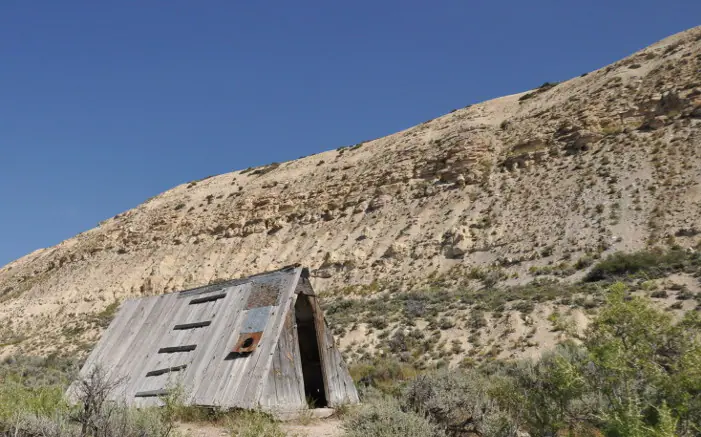
Some of the most accessible exposures rim the basins, while thick successions also continue underground. Fossil-bearing laminated limestone near Fossil Basin is only one expression of a formation that also includes deltaic sandstone, shoreline mudstone, carbonate beds, and deep-basin oil shale.
How did it form?
Sediment accumulated as lake levels, salinity, sediment supply, and climate changed through time. Nearshore areas received sand and silt from rivers; quieter water preserved fine carbonate and organic material in thin layers. Evaporation in closed or restricted lake phases concentrated dissolved chemicals and produced distinctive authigenic minerals.
Because the lakes evolved independently, a statement that is true for one basin or member may not apply to another. The formation is best understood as a family of lake deposits rather than a single identical layer spread across three states.
Fossil record
Fine-grained beds preserve fish, plants, insects, turtles, crocodilians, birds, bats, and other organisms. At Fossil Butte, rapid burial and quiet lake-bottom conditions produced especially detailed fossils, including complete fish and delicate leaves and insects.
The fossil record varies sharply with depositional setting. Some central-lake layers are rich in articulated fossils, whereas saline or strongly organic intervals may record mainly microorganisms, pollen, or chemically stressful conditions.
Compare observable anatomy in the fossil identification guides, then review the U.S. fossil collecting-law guide before disturbing any find. A formation-level record does not prove a fossil is present, exposed, common, or legal to collect at a particular place.
Minerals and geological resources
Quartz, dolomite, and feldspar are widespread. USGS core studies also document calcite, clay minerals, analcime, albite, pyrite, marcasite, and basin-centered evaporite or authigenic minerals such as nahcolite and dawsonite.
Mineral distribution is stratigraphically and geographically controlled. Nahcolite, for example, is an industrial soda-ash resource in parts of the Piceance Basin, not a blanket feature of every Green River outcrop. Organic-rich beds are also a major oil-shale resource, though oil shale is a rock resource rather than a mineral species.
Identify rocks and minerals named in this guide
Use physical properties to investigate materials discussed above. A formation name or mapped location supports context, but it cannot identify a hand sample by itself.
What to know in the field
- Thinly laminated fossil beds can split easily; collecting is prohibited at Fossil Butte National Monument.
- Oil-shale slopes may be steep, loose, and hot, and old resource workings can be hazardous.
- Check the basin and member name before comparing ages, fossils, or minerals between localities.
Formation, fossil, and mineral information is educational. It does not establish land ownership, legal access, collecting permission, specimen identity, or present-day field conditions.
Authoritative sources
This guide synthesizes the following sources in original language. Consult the linked records for local stratigraphic detail and the underlying scientific literature.
- Green River Formation mineral occurrence data U.S. Geological Survey
- Distribution of mineral phases in the Green River Formation U.S. Geological Survey
- Geolex Green River references U.S. Geological Survey
Editorial review: September 16, 2026.