
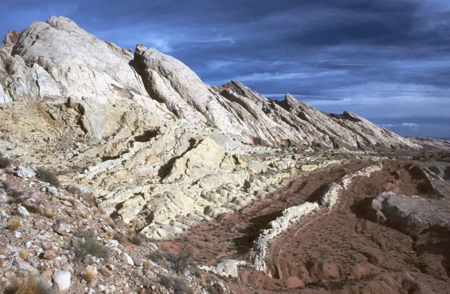

Major geologic regions of Utah
Colorado Plateau
Broad uplifts, basins, monoclines, mesas, and deeply cut canyons expose thick Paleozoic and Mesozoic sedimentary sequences. Resistant sandstone forms cliffs and arches; softer mudstone creates slopes and badlands.
Basin and Range
Western Utah consists of north–south mountain blocks separated by sediment-filled valleys. Extension along normal faults produced the alternating relief and continues along active fault zones.
Wasatch and Uinta Mountains
The Wasatch marks a dramatic boundary between provinces. The east–west Uinta Mountains expose older rocks and record Laramide compression, while glaciation carved high valleys and cirques.
Lake Bonneville basin
Shorelines, gravel bars, marl, and lake-bottom sediment record a much larger Pleistocene lake. Great Salt Lake is a saline remnant, but its chemistry and extent have changed through time.
Geologic history
Precambrian rocks record fragments of continental growth, metamorphism, intrusion, and erosion, but most visible Utah scenery comes from the younger Phanerozoic record. Paleozoic seas repeatedly covered the region, leaving quartz sandstone, limestone, dolostone, shale, reef deposits, and basin evaporites.
Mesozoic environments shifted from tidal flats and river systems to vast dune fields, inland seas, coastal plains, and dinosaur-bearing floodplains. The Navajo Sandstone records windblown dunes, while the Chinle and Morrison formations preserve river and floodplain deposits with petrified wood or vertebrate fossils in particular areas.
Compression raised mountain systems and warped the Colorado Plateau late in the Mesozoic and early Cenozoic. Later extension opened the Basin and Range, and igneous activity created intrusions, volcanic fields, and mineral belts. Lake Bonneville, alpine glaciers, river incision, and ongoing faulting shaped the recent landscape.
Common and significant rocks and minerals
Sandstone and mudstone
Triassic and Jurassic red beds, dune sandstone, and floodplain deposits dominate many plateau landscapes, but similar colors can belong to different mapped units.
Limestone and dolostone
Paleozoic marine carbonate rocks form mountain ridges, cliffs, caves, fossil beds, and important groundwater systems.
Halite, gypsum, and potash minerals
Restricted basins and evaporating water concentrated salts in units such as the Paradox basin succession and in younger closed basins.
Copper, gold, silver, lead, and zinc minerals
Intrusions and hydrothermal systems created major mineral belts, especially in western Utah. Historic workings may be unstable, contaminated, or claimed.
Uranium and vanadium minerals
Localized deposits occur in particular Colorado Plateau sandstone units. Mineralized ground and mine waste can present radiation and chemical hazards.
A statewide occurrence does not mean a material is present, collectible, or economically valuable at a particular location. Confirm the mapped unit, land status, and applicable rules.
Fossil record
Utah’s fossil record includes Cambrian trilobites, Paleozoic marine invertebrates, Triassic trackways and petrified wood, Jurassic dinosaurs, Cretaceous marine and terrestrial organisms, and Cenozoic lake and mammal assemblages. No single site or formation contains that entire record.
Fossil preservation depends on sedimentary environment and later alteration. Vertebrate fossils on federal land are protected and generally require permits; casual collection rules for common invertebrate or plant fossils differ by agency and location.
Use the fossil identification guides to compare anatomy and preservation, and check the collecting-law guide before touching or moving a find. Statewide fossil history does not establish site-level presence, ownership, access, or permission.
Groundwater and geologic hazards
Groundwater moves through basin-fill sediment, fractured bedrock, sandstone, and carbonate aquifers. Salt-rich strata, mine districts, and evaporative basins can influence water chemistry, while pumping and drought affect availability.
Earthquake risk is concentrated along active faults including the Wasatch fault zone, but rockfall, landslides, flash floods, debris flows, collapsible soil, swelling clay, radon, and abandoned mines are also important. Conditions vary at site scale.
Field notes and limitations
- Do not identify a formation by red color alone; confirm stratigraphic position and contacts.
- Desert washes and slot canyons can flood even when the local sky is clear.
- Biological soil crusts are living surfaces; stay on durable routes.
- Check BLM, Forest Service, park, tribal, state, private, and claim-specific rules before collecting.
This guide is educational. It is not a legal boundary, access determination, mineral-rights opinion, professional hazard assessment, water-well evaluation, or collecting authorization.
Authoritative state geology sources
LithoMap wrote this guide in original language from the broad patterns supported by these state geological-survey and agency resources.
- Geologic History of Utah Utah Geological Survey
- Utah Geological Survey Utah Geological Survey
- Geologic maps and data Utah Geological Survey
Editorial review: September 17, 2026.