
_1.jpg)
Where is the Mount Simon Sandstone?
The unit is exposed around parts of Wisconsin and Minnesota but lies hundreds to thousands of feet underground across the Illinois and Michigan basins and neighboring states. It thins over basement highs and thickens toward basin centers.
Its lower surface covers deeply weathered Precambrian rock, while the finer Eau Claire Formation usually lies above. Historical group assignments and the inclusion of local sandstone equivalents vary by state.
How did it form?
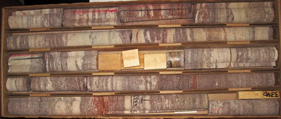
Coarse sand and local gravel first accumulated across an eroded basement landscape, followed by finer coastal and shallow-marine sand as Cambrian seas advanced. Cross-bedding records migrating dunes, bars, or channels in different parts of the system.
Burial compacted and cemented the sandstone but preserved substantial pore space in many areas. Water becomes increasingly saline toward deep basin interiors, where the unit is isolated from modern recharge.
Fossil record
Body fossils are rare in most of the coarse sandstone. Vertical Skolithos-like burrows and other trace fossils occur in some beds and indicate colonization of sandy substrates.
Sparse fossils make regional position and well-log character more important than paleontology for identification. Fossil absence should not be interpreted as a lifeless Cambrian environment.
Compare observable anatomy in the fossil identification guides, then review the U.S. fossil collecting-law guide before disturbing any find. A formation-level record does not prove a fossil is present, exposed, common, or legal to collect at a particular place.
Minerals and geological resources
Quartz is dominant, with feldspar, clay minerals, iron oxides, and local carbonate cement. Basal beds may contain pebbles derived from underlying granite and other Precambrian rocks.
The Mount Simon is a groundwater aquifer and a studied reservoir for carbon dioxide storage. Suitability depends on porosity, permeability, caprock integrity, depth, and brine chemistry—not merely the formation name.
Identify rocks and minerals named in this guide
Use physical properties to investigate materials discussed above. A formation name or mapped location supports context, but it cannot identify a hand sample by itself.
What to know in the field
- Surface exposures represent only a small, shallow part of a much larger subsurface unit.
- Loose or undercut sandstone faces can collapse without warning.
- Deep-well water may be saline and is not equivalent to water quality near recharge areas.
Formation, fossil, and mineral information is educational. It does not establish land ownership, legal access, collecting permission, specimen identity, or present-day field conditions.
Authoritative sources
This guide synthesizes the following sources in original language. Consult the linked records for local stratigraphic detail and the underlying scientific literature.
- Geolex Mount Simon record U.S. Geological Survey
- Principal U.S. frac-sand source units U.S. Geological Survey
- Northern Midwest aquifer hydrogeology U.S. Geological Survey
Editorial review: September 16, 2026.