
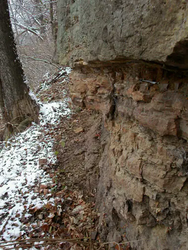

Where is the Maquoketa Shale?
Maquoketa rocks crop out around the margins of the Illinois and Michigan basins and beneath glacial deposits across much of the region. The name may denote a formation or group containing several formations and members.
Bluish or greenish shale, fossiliferous carbonate beds, and locally sandy or iron-rich intervals occur at different levels. Glacial cover and weathering mean the unit is far more extensive underground than surface exposure suggests.
How did it form?
Marine mud accumulated across a broad shelf while storms and shifts in water depth introduced carbonate debris and silt. Oxygen conditions and sediment supply varied, producing fossil-rich limestone, quiet-water shale, and locally pyritic or phosphatic beds.
Later burial compacted the shale and cemented carbonate layers. Erosion before younger Silurian deposition created important regional breaks, and Pleistocene glaciers subsequently concealed or re-exposed the bedrock.
Fossil record
Brachiopods, bryozoans, mollusks, trilobites, graptolites, crinoid fragments, and cephalopods occur, with distinctive assemblages in particular members. Some beds contain abundant small pyritized or phosphatic shells.
Fossil abundance is highly uneven. Calcareous layers may be crowded with shells while nearby shale is sparsely fossiliferous, so local member identification matters.
Compare observable anatomy in the fossil identification guides, then review the U.S. fossil collecting-law guide before disturbing any find. A formation-level record does not prove a fossil is present, exposed, common, or legal to collect at a particular place.
Minerals and geological resources
Clay minerals, quartz, calcite, and dolomite are common; pyrite and phosphate occur locally. Iron oxides develop during weathering, and the Neda interval at the top is locally rich in goethite and hematite ooids.
The shale acts as a confining layer in regional groundwater systems. Pyrite-bearing material can acidify drainage when excavated or exposed to air and water.
Identify rocks and minerals named in this guide
Use physical properties to investigate materials discussed above. A formation name or mapped location supports context, but it cannot identify a hand sample by itself.
What to know in the field
- Glacial sediment commonly hides the bedrock contact even where maps show the unit beneath the surface.
- Wet shale slopes are weak and can slump beneath resistant carbonate beds.
- Confirm whether the local survey uses Maquoketa as a formation or a group.
Formation, fossil, and mineral information is educational. It does not establish land ownership, legal access, collecting permission, specimen identity, or present-day field conditions.
Authoritative sources
This guide synthesizes the following sources in original language. Consult the linked records for local stratigraphic detail and the underlying scientific literature.
- Geolex Maquoketa references U.S. Geological Survey
- Hydrogeology of the northern Midwest U.S. Geological Survey
Editorial review: September 16, 2026.