
_11_(44085616790).jpg)
Where is the New Albany Shale?
The New Albany is exposed around portions of the Illinois Basin in Indiana and Kentucky and continues beneath Illinois and adjoining areas. State usage may treat it as a formation or group and may divide it into different members.
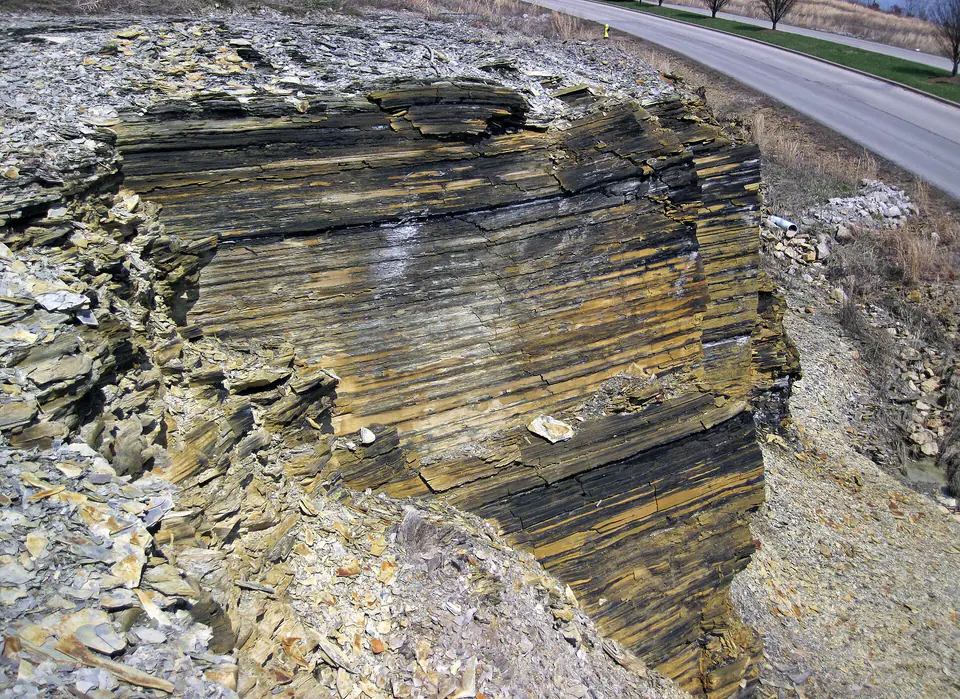
Thickness and age expand toward the basin interior. Weathered outcrops can look rusty, pale, or crumbly rather than black because pyrite and organic matter react near the surface.
How did it form?
Fine mud and organic particles settled through a layered sea in which bottom water was commonly oxygen-poor. Periodic circulation and shoreline shifts produced greenish-gray, bioturbated, silty, or carbonate-rich beds among the dark shale.
Compaction and burial converted the sediment to shale and generated hydrocarbons from organic matter. Weathering later altered feldspar, calcite, pyrite, and chlorite and formed sulfate and iron minerals near exposed surfaces.
Fossil record
Conodonts, radiolarians, spores, Tasmanites-like organic microfossils, fish scales and teeth, wood fragments, and thin-shelled brachiopods occur. Better-oxygenated marginal facies may contain a broader shelly fauna and abundant trace fossils.
Dark shale may contain few obvious hand-specimen fossils even when microscopic and chemical evidence of life is abundant. Fossil expectations must therefore follow facies and member, not color alone.
Compare observable anatomy in the fossil identification guides, then review the U.S. fossil collecting-law guide before disturbing any find. A formation-level record does not prove a fossil is present, exposed, common, or legal to collect at a particular place.
Minerals and geological resources
Clay minerals and quartz dominate, with feldspar, calcite, pyrite, and organic matter in varying amounts. Weathering can form gypsum, jarosite, goethite, and other iron oxides or sulfate salts.
Natural gas is an organic geological resource rather than a mineral. Fresh pyrite-bearing shale can produce acidic drainage, and roadside weathering crusts are not reliable indicators of unaltered rock composition.
Identify rocks and minerals named in this guide
Use physical properties to investigate materials discussed above. A formation name or mapped location supports context, but it cannot identify a hand sample by itself.
What to know in the field
- Fresh and weathered shale can look very different; record whether a sample came from intact bedrock.
- Shale slopes fail easily, especially when wet or undercut.
- Use state-specific terminology because rank and member names change around the basin.
Formation, fossil, and mineral information is educational. It does not establish land ownership, legal access, collecting permission, specimen identity, or present-day field conditions.
Authoritative sources
This guide synthesizes the following sources in original language. Consult the linked records for local stratigraphic detail and the underlying scientific literature.
- Kentucky Devonian stratigraphy U.S. Geological Survey
- New Albany paleoenvironment U.S. Geological Survey
- New Albany weathering mineralogy U.S. Geological Survey
Editorial review: September 16, 2026.