
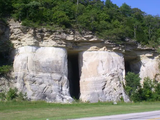

Where is the St. Peter Sandstone?
The St. Peter crops out around structural highs and basin margins in the Upper Midwest and Ozark region and lies deep underground within the Illinois and Michigan basins. Its thickness and lower contact reflect an irregular older erosion surface.
Clean, pale sandstone is characteristic, but shale, carbonate cement, and dolomitic intervals occur locally. Some older usage combines adjacent beds differently, so map-unit boundaries must be checked regionally.
How did it form?
Long transport and repeated wave or wind reworking removed many unstable grains and rounded the surviving quartz. Marine transgression redistributed that sand across a broad surface, producing well-sorted beds and local cross-stratification.
During burial, quartz, dolomite, calcite, anhydrite, illite, and potassium feldspar formed or dissolved in different basin zones. Those changes strongly affect porosity, groundwater flow, and industrial quality.
Fossil record
Body fossils are generally sparse because clean sand was an energetic and often mobile substrate. Trace fossils and rare conodont-bearing or shaly intervals provide more useful biological and age information.
The absence of conspicuous fossils is itself characteristic of many exposures, but it should not be treated as proof of a specific formation without stratigraphic context.
Compare observable anatomy in the fossil identification guides, then review the U.S. fossil collecting-law guide before disturbing any find. A formation-level record does not prove a fossil is present, exposed, common, or legal to collect at a particular place.
Minerals and geological resources
Quartz commonly makes up most of the rock. Minor feldspar, clay minerals, glauconite, dolomite, calcite, anhydrite, iron oxides, and authigenic illite occur in some areas.
High-purity sand has been quarried for glass and other industrial uses, and the formation is an important aquifer. Both values depend on local grain size, cement, depth, and water chemistry.
Identify rocks and minerals named in this guide
Use physical properties to investigate materials discussed above. A formation name or mapped location supports context, but it cannot identify a hand sample by itself.
What to know in the field
- Quarries are active industrial sites and require explicit permission.
- Friable sandstone cliffs can shed blocks or collapse along undercut faces.
- A clean quartz sandstone is not diagnostic by itself; confirm its position between mapped units.
Formation, fossil, and mineral information is educational. It does not establish land ownership, legal access, collecting permission, specimen identity, or present-day field conditions.
Authoritative sources
This guide synthesizes the following sources in original language. Consult the linked records for local stratigraphic detail and the underlying scientific literature.
- St. Peter diagenesis in the Illinois Basin U.S. Geological Survey
- St. Peter conodonts and stratigraphy U.S. Geological Survey
- Cambrian–Ordovician aquifer system U.S. Geological Survey
Editorial review: September 16, 2026.