

Where is the Ohanapecosh Formation?
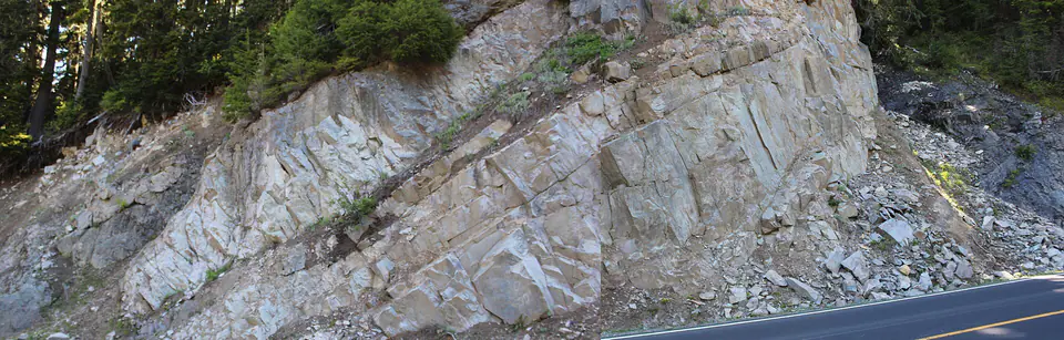
Ohanapecosh rocks are exposed in and around Mount Rainier National Park and elsewhere in the southern and central Cascades. Folding, faulting, alteration, and younger volcanic cover make contacts difficult to trace in some areas.
The formation can exceed thousands of feet in thickness and includes interlayered lava-flow complexes, coarse volcanic debris, water-laid sandstone and silt, ash-flow deposits, and rhyolitic rock.
How did it form?
Eruptions supplied andesite-dominated lava and fragmental material to a landscape with shallow marine water and volcanic islands. Ash clouds, lahars, and pyroclastic flows entered water and became thick breccia and volcaniclastic sediment.
Burial and low-grade metamorphism altered volcanic glass and primary minerals to zeolite-facies assemblages. The formation was then folded, uplifted, deeply eroded, and weathered before younger Cascade volcanic units covered it.
Fossil record
Fossils are sparse across much of the coarse volcanic succession. Plant remains have helped constrain age in selected finer-grained beds, but many classic sections yielded no identifiable fossils.
The uneven record reflects depositional conditions: hot lava, debris flows, and coarse breccia rarely preserve organisms, whereas quieter water-laid sediment offers a better chance of retaining plant material.
Compare observable anatomy in the fossil identification guides, then review the U.S. fossil collecting-law guide before disturbing any find. A formation-level record does not prove a fossil is present, exposed, common, or legal to collect at a particular place.
Minerals and geological resources
Original volcanic rocks contain plagioclase, pyroxene, and other minerals typical of andesite, with less common basaltic, dacitic, and rhyolitic compositions. Alteration produced zeolites, clay minerals, chlorite, calcite, and related secondary phases.
The altered mineral assemblage records burial temperature and water-rock reaction. It is not uniform enough to infer a collectible pocket from the formation name or a broad map polygon.
Identify rocks and minerals named in this guide
Use physical properties to investigate materials discussed above. A formation name or mapped location supports context, but it cannot identify a hand sample by itself.
What to know in the field
- Steep Cascade exposures are commonly fractured, vegetated, wet, and prone to rockfall.
- Natural materials are protected within Mount Rainier National Park.
- Do not confuse ancient Ohanapecosh volcanic rocks with much younger Mount Rainier lava and lahar deposits.
Formation, fossil, and mineral information is educational. It does not establish land ownership, legal access, collecting permission, specimen identity, or present-day field conditions.
Authoritative sources
This guide synthesizes the following sources in original language. Consult the linked records for local stratigraphic detail and the underlying scientific literature.
- Geology of Mount Rainier National Park U.S. Geological Survey
- Geolex Ohanapecosh references U.S. Geological Survey
- Geologic formations at Mount Rainier National Park Service
Editorial review: September 16, 2026.