
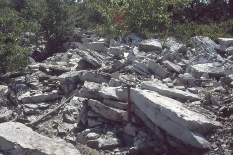

Where is the Tuscarora Formation?
Tuscarora sandstone and quartzite form long, narrow ridges in Pennsylvania, Maryland, Virginia, and West Virginia. The unit follows tightly folded Appalachian structures and may be repeated by faults.
Naming varies between Formation, Sandstone, and Quartzite, and not every white ridge-forming sandstone is Tuscarora. Contacts and regional equivalents should be taken from the appropriate state map.
How did it form?
Quartz-rich sand and local pebbles were reworked in energetic coastal and shallow-marine settings as erosion supplied sediment to the Appalachian basin. Cross-bedding and burrows record moving sand and periods of seafloor colonization.
Deep burial and Appalachian deformation compacted and cemented the sandstone, locally producing very hard quartzite. Folding then tilted beds steeply and erosion isolated them as resistant ridges.
Fossil record
Body fossils are generally sparse, but trace fossils such as vertical burrows can be conspicuous. Rare shelly or shaly beds preserve better biological evidence and help constrain age.
A track-like marking should not be identified from shape alone; cross-sections and bedding context are needed to separate burrows from sedimentary structures or fractures.
Compare observable anatomy in the fossil identification guides, then review the U.S. fossil collecting-law guide before disturbing any find. A formation-level record does not prove a fossil is present, exposed, common, or legal to collect at a particular place.
Minerals and geological resources
Quartz is overwhelmingly dominant in many beds. Minor feldspar, mica, clay minerals, and iron oxides occur, and silica cement produces quartzite where recrystallization is strongest.
Hard stone has been used locally for aggregate and construction. Fractures control most groundwater movement because the intact quartz-rich rock has little pore space.
Identify rocks and minerals named in this guide
Use physical properties to investigate materials discussed above. A formation name or mapped location supports context, but it cannot identify a hand sample by itself.
What to know in the field
- Talus below quartzite cliffs is unstable and may hide holes between blocks.
- Steeply dipping beds can shed slabs along joints and bedding planes.
- Formation rank and age limits differ across state boundaries.
Formation, fossil, and mineral information is educational. It does not establish land ownership, legal access, collecting permission, specimen identity, or present-day field conditions.
Authoritative sources
This guide synthesizes the following sources in original language. Consult the linked records for local stratigraphic detail and the underlying scientific literature.
- Geolex Tuscarora unit record U.S. Geological Survey
- Geolex Tuscarora references U.S. Geological Survey
Editorial review: September 16, 2026.