

Where is the Lock Haven Formation?
The formation is mapped principally in north-central Pennsylvania, where folded ridges and valleys expose it between the Brallier and Catskill formations. It replaces part of the older, now-abandoned Chemung terminology in current Pennsylvania usage.
Sandstone proportion and fossil content change laterally and upward. Weathering creates ledges above shale slopes, but isolated sandstone cannot be assigned confidently without its stratigraphic neighbors.
How did it form?
Mud, silt, and sand entered the Appalachian foreland basin from eastern highlands. Storms and river-fed plumes carried sand across the marine shelf, creating lenticular, cross-bedded sandstone within quieter-water shale.
Upward coarsening and increasing terrestrial influence mark the long transition toward Catskill river and delta deposits. Later Appalachian deformation folded and fractured the section into today’s ridges and valleys.
Fossil record
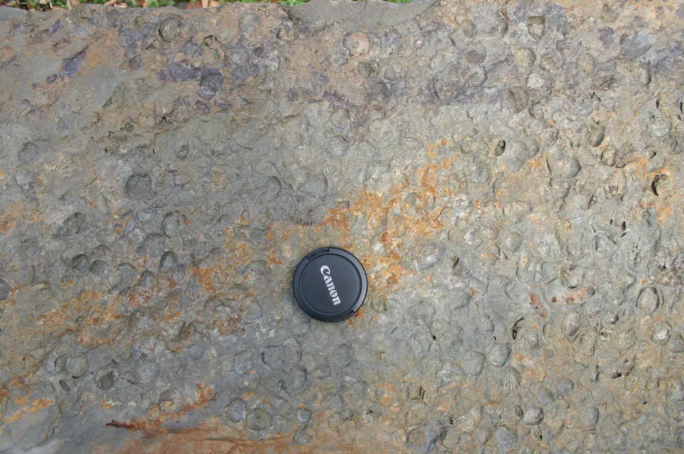
Brachiopods, bivalves, gastropods, cephalopods, crinoid debris, and trace fossils occur in marine beds. Assemblages vary with water depth, oxygen, and distance from sediment sources.
Fossil-rich layers can sit close to nearly barren sandstone or shale. The formation’s broad marine character does not predict fossils at every outcrop.
Compare observable anatomy in the fossil identification guides, then review the U.S. fossil collecting-law guide before disturbing any find. A formation-level record does not prove a fossil is present, exposed, common, or legal to collect at a particular place.
Minerals and geological resources
Quartz, clay minerals, feldspar, mica, and calcite are common, with pyrite and iron-rich concretions locally present. Weathering converts iron-bearing minerals to red, yellow, or brown oxides.
Sandstone and shale have chiefly local aggregate or groundwater significance. Pyritic rock and steep spoil or roadcut exposures warrant caution.
Identify rocks and minerals named in this guide
Use physical properties to investigate materials discussed above. A formation name or mapped location supports context, but it cannot identify a hand sample by itself.
What to know in the field
- Thin sandstone ledges can detach above weathered shale slopes.
- Many exposures are along roads or on private land and are not safe or open collecting sites.
- Use modern Pennsylvania maps because Chemung terminology persists in older literature.
Formation, fossil, and mineral information is educational. It does not establish land ownership, legal access, collecting permission, specimen identity, or present-day field conditions.
Authoritative sources
This guide synthesizes the following sources in original language. Consult the linked records for local stratigraphic detail and the underlying scientific literature.
- Geolex Lock Haven references U.S. Geological Survey
- Stratigraphic nomenclature changes U.S. Geological Survey
Editorial review: September 16, 2026.