

Where is the Ogallala Formation?
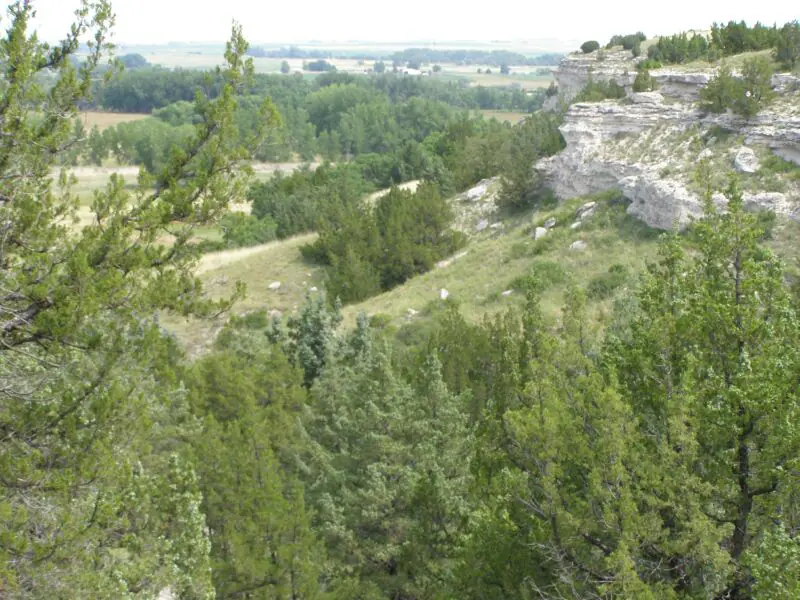
Ogallala deposits underlie or crop out across a broad belt from South Dakota and Wyoming to Texas and New Mexico. They cap tablelands, fill older valleys, and form the resistant rim of escarpments where caliche or cemented sandstone protects softer sediment.
The formation is highly variable because streams occupied different routes through time. A nearby exposure may shift from loose sand and gravel to cemented sandstone, silt, volcanic ash, or carbonate-rich soil horizons.
How did it form?
East-flowing river systems carried sediment from the uplifting Rocky Mountains and spread it across preexisting valleys and plains. Repeated channel migration built overlapping bodies of gravel, sand, silt, and clay.
Soil formation and groundwater evaporation precipitated calcium carbonate as caliche, especially near the top. Some sediment became cemented into resistant rock, while much remained only weakly consolidated and now serves as an important aquifer.
Fossil record
Fossil mammals, tortoises, plants, seeds, and freshwater organisms occur in selected intervals. Horse, camel, rhinoceros, proboscidean, and other vertebrate remains help document changing Great Plains environments.
Fossil seeds have been especially useful for regional correlation, but fossil-bearing horizons are discontinuous. Reworked older shells or rock fragments in stream gravel should not be mistaken for Ogallala-age organisms.
Compare observable anatomy in the fossil identification guides, then review the U.S. fossil collecting-law guide before disturbing any find. A formation-level record does not prove a fossil is present, exposed, common, or legal to collect at a particular place.
Minerals and geological resources
Quartz and feldspar dominate much sand and gravel, with calcite concentrated in cement and caliche. Clay minerals occur in fine sediment, while volcanic ash contributes glass and altered material in some beds.
Silica can form opaline cement or hard quartz-rich lenses. Gravel also contains many recycled rock types from the mountains, so an individual pebble may be far older than the formation carrying it.
Identify rocks and minerals named in this guide
Use physical properties to investigate materials discussed above. A formation name or mapped location supports context, but it cannot identify a hand sample by itself.
What to know in the field
- Loose sand and gravel can collapse in steep cuts or excavations.
- The aquifer is a water-bearing system, not an underground lake, and saturated thickness varies greatly.
- Caprock blocks can detach above softer slopes, especially along escarpments and reservoir shorelines.
Formation, fossil, and mineral information is educational. It does not establish land ownership, legal access, collecting permission, specimen identity, or present-day field conditions.
Authoritative sources
This guide synthesizes the following sources in original language. Consult the linked records for local stratigraphic detail and the underlying scientific literature.
- High Plains aquifer and Ogallala Formation U.S. Geological Survey
- Geolex Ogallala references U.S. Geological Survey
- Ogallala geology and hydrogeology in Wyoming U.S. Geological Survey
Editorial review: September 16, 2026.