
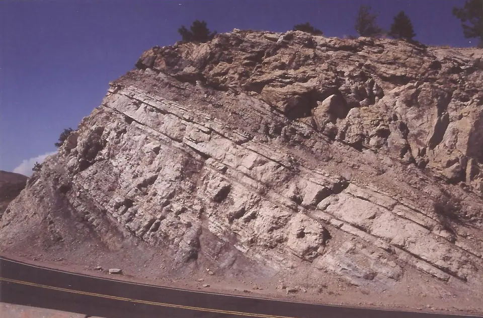

Where is the Dakota Sandstone?
Dakota-named rocks occur across a broad swath of the central and western United States. They form hogbacks along parts of the Front Range, ledges on the Great Plains, and sandstone benches around plateau basins.
The name is not uniform nationally. Depending on location and publication, Dakota may be a formation, sandstone, or group, and some rocks once called Dakota now carry names such as South Platte, Naturita, or other regional formations.
How did it form?
Rivers delivered sand and gravel across a low coastal plain. As the Cretaceous sea advanced, beaches, tidal channels, estuaries, lagoons, and swamps shifted landward, producing interbedded sandstone, carbonaceous shale, clay, and local coal.
Channel migration and repeated shoreline movement created laterally variable bodies rather than one continuous blanket of sandstone. Regional nomenclature reflects those real facies changes as well as a long history of geological mapping.
Fossil record
Plant leaves, wood, pollen, and spores are common in some continental and swamp deposits. Marine-influenced beds can contain bivalves and other invertebrates, while dinosaur tracks or fragmentary vertebrate remains occur locally.
The fossil record changes with the shoreline. A carbonaceous clay may preserve plants, a beach sandstone may preserve burrows or shells, and a clean channel sandstone may contain little recognizable fossil material.
Compare observable anatomy in the fossil identification guides, then review the U.S. fossil collecting-law guide before disturbing any find. A formation-level record does not prove a fossil is present, exposed, common, or legal to collect at a particular place.
Minerals and geological resources
Quartz dominates most sandstone, with feldspar, clay minerals, mica, and heavy accessory grains in smaller amounts. Iron oxides produce brown weathering and concretions; silica or calcite may cement resistant ledges.
Clay-rich intervals have supplied refractory material in some districts, and local coal or lignite records vegetated wetlands. Those resources are not uniform, and coal is an organic rock rather than a mineral.
Identify rocks and minerals named in this guide
Use physical properties to investigate materials discussed above. A formation name or mapped location supports context, but it cannot identify a hand sample by itself.
What to know in the field
- Always check the local survey’s rank and definition before comparing Dakota sites across states.
- Sandstone hogbacks create steep, loose slopes and traffic hazards at roadcuts.
- Coal prospects, quarries, and water wells do not imply public access to the surrounding formation.
Formation, fossil, and mineral information is educational. It does not establish land ownership, legal access, collecting permission, specimen identity, or present-day field conditions.
Authoritative sources
This guide synthesizes the following sources in original language. Consult the linked records for local stratigraphic detail and the underlying scientific literature.
- Geolex Dakota references U.S. Geological Survey
- Geolex search guidance for regional unit names U.S. Geological Survey
Editorial review: September 16, 2026.