
_7_(38417957134).jpg)
Where is the Niobrara Formation?
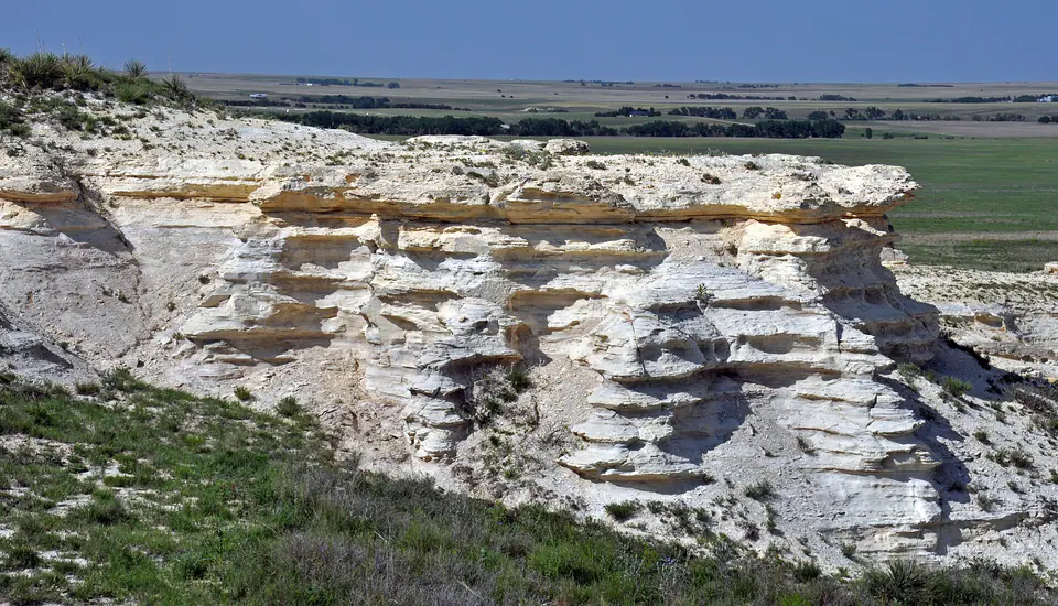
Niobrara strata extend widely across the Great Plains and into Rocky Mountain basins. The unit is commonly divided into the Fort Hays Limestone Member below and the Smoky Hill Chalk or Shale Member above, although rank and naming vary by basin.
Outcrops range from the bluffs near the Niobrara River to the chalk badlands of western Kansas and narrow upturned belts along the mountain front. Equivalent rocks may be treated as a member of a larger shale unit elsewhere.
How did it form?
Calcareous mud and microscopic skeletal material settled on the floor of the Western Interior Seaway. Changes in sediment supply and seawater conditions alternated harder limestone and chalk with softer calcareous shale. Thin bentonite beds record ash from distant volcanoes.
The lower Fort Hays is generally more limestone-rich, while the overlying Smoky Hill contains more chalk and shale. Compaction, cementation, and later uplift control whether the unit forms cliffs, rolling uplands, or a deeply buried reservoir.
Fossil record
Marine fossils include inoceramid bivalves, oysters, ammonites and other cephalopods, fish, sharks, marine reptiles, and microscopic plankton. Chalk beds can also preserve rare birds and other vertebrates.
Distinct fossil species help correlate individual horizons over large distances, but fossil zones and ages are not identical everywhere. A specimen’s stratigraphic position matters as much as the formation name.
Compare observable anatomy in the fossil identification guides, then review the U.S. fossil collecting-law guide before disturbing any find. A formation-level record does not prove a fossil is present, exposed, common, or legal to collect at a particular place.
Minerals and geological resources
Calcite dominates chalk and limestone, accompanied by clay minerals and fine quartz. Bentonite layers contain altered volcanic ash, and gypsum or iron sulfides may occur locally in shale or weathered exposures.
Oil and gas are produced from fractured or engineered Niobrara reservoirs in some basins, but hydrocarbons are not minerals and surface exposures do not indicate a productive reservoir. Fossil- and calcite-bearing chalk should not be confused with construction lime or pure industrial chalk.
Identify rocks and minerals named in this guide
Use physical properties to investigate materials discussed above. A formation name or mapped location supports context, but it cannot identify a hand sample by itself.
What to know in the field
- Chalk cliffs and badland faces can collapse without warning; avoid undercut walls.
- Vertebrate fossils are protected on federal land and require research permits for excavation.
- Member names and formation rank differ substantially across basins.
Formation, fossil, and mineral information is educational. It does not establish land ownership, legal access, collecting permission, specimen identity, or present-day field conditions.
Authoritative sources
This guide synthesizes the following sources in original language. Consult the linked records for local stratigraphic detail and the underlying scientific literature.
- Geolex Niobrara references U.S. Geological Survey
- USGS geologic names lexicon documentation U.S. Geological Survey
Editorial review: September 16, 2026.